
|

|

Total area - 322,463 sq km
Land area - 318,003 sq km
Water area - 4,460 sq km
Size comparative to U.S. territory - A little bigger than New Mexico
List all countries which share a border (if island include body(ies) of water bordered) - Burkina Faso 545 km, Ghana 720 km, Guinea 816 km, Liberia 778 km, Mali 599 km
Total distance of all land boundaries - 3,458 km
Total distance of coastline - 515 km
Description of climate - “tropical along coast, semiarid in far north; three seasons - warm and dry (November to March), hot and dry (March to May), hot and wet (June to October)”
Description of Terrain - “mostly flat to undulating plains; mountains in northwest”
Point of lowest elevation - Gulf of Guinea 0 m
Point of highest elevation - Monts Nimba 1,752 m
All information from cia.gov.

|

|
Population
Population (Mid-2012)
23,740,424
Density (people per sq. km)
73.6 people / sq. km
Net Migration Rate (# per 1000 people)
0 migrant(s)/1,000 population (2016 est.)
Birth Rate (# per 1000 people)
28.2 births/1,000 population (2016 est.)
Death Rate (# per 1000 people)
9.5 deaths/1,000 population (2016 est.)
Rate of Natural Increase
18.7/1.87%
Population Growth Rate
1.88% (2016 est.)
Infant Mortality Rate (# of deaths per 1000 live births)
57.2 deaths/1,000 live births
Total Fertility Rate (average # of children per woman)
3.46 children born/woman (2016 est.)
Population Age <15 %
37.45% (male 4,483,215/female 4,407,595)
Population Ages 65+ %
3.42% (male 389,551/female 422,244) (2016 est.)
Dependency Rate (add together Population Age <15 % and Ages 65+ %)
40.87%
Life Expectancy at Birth (total)
58.7 years
Life Expectancy at Birth Females
59.9 years (2016 est.)
Life Expectancy at Birth Males
57.5 years
Primary School Completion Rate Females
39%
Primary School Completion Rate Males
54%
Secondary School Enrollment Net Females
No data
Secondary School Enrollment Net Males
No data
GNI PPP per capita in US$
2,940
Economically Active Females 15+
51%
Economically Active Males 15+
82%
Mobile Phone Subscribers (# per 100)
106
Motor Vehicles (# per 1000)
0
Undernourished Population
29%
Underweight Children Under Age 5
15.7%
HIV/AIDS Among People Ages 15-49
3.9%
Population Pyramids
1995

2010

2025

2050


The Ivory Coast is likely in Stage 2 of the DTM. The above picture shows that countries in Stage 2 have a high CBR, a declining CDR, and a very high NIR. The Ivory Coast’s population have these trends. Also, the Ivory Coast has not been developed. However, there are no countries in Stage 1 of the DTM, so the Ivory Coast could not be classified as such. Therefore, the Ivory Coast should be classified as a Stage 2 country.

www.bit.ly/2d6gt2e
In this graph, child mortality is on the y-axis, and total fertility rate is on the x-axis. I chose these two topics because the Ivory Coast is in Stage 2 of the DTM. Most Stage 2 countries have high CBRs and total fertility rates because they are agriculturally-based. However, they also lack the healthcare and sanitation of more developed countries. This means that they likely also have higher child mortality rates. Therefore, I inferred that a relationship may exist between total fertility rate and child mortality.
Sources: cia.gov, data.worldbank.org, prb.org
Culture
Ethnic Groups

Languages:
French (official)
60 native dialects (Dioula is the most widely spoken)
French (official)
60 native dialects (Dioula is the most widely spoken)
Religions

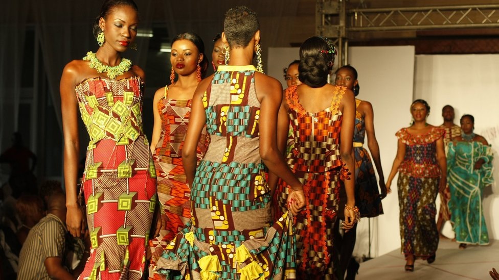
Cultural Pictures


The Amazing Race
This challenge will take place at the Chez Ambroise Restaurant in Abidjan, Ivory Coast.

- Challengers will arrive at Chez Ambroise.
- They will order 5-pound meal of yam fries.
- They will eat the yam fries.
- After finishing, they will ring a bell to signal to officials that they have completed the task.

The “check-in” point is at the exit of the restaurant.

Cultural Journal Report
Senufo Arts and Poro Initiation in Northern Côte d’Ivoire by Susan Elizabeth Gagliardi
Date the article was written: January 2010
Click here to read this article.
The article explains the poro initiation association and the Senufo arts in the northern part of the Ivory Coast. Poro served as an age initiation for boys and girls. Poro initiates wore masks that varied over time. Scholars have yet to determine the exact meaning behind these masks. Although not used in every Senufo community today, poro has transmitted histories, genealogies, other knowledge, and led to diverse art throughout the northern part of the Ivory Coast.
The article describes the fascinating practice of poro. The idea that people must undergo initiations to join poro associations calls to mind religious ceremonies and processes such as Christianity’s confirmation. The poro masks themselves also serve as an absorbing aspect of the article, especially since no one has been able to determine their exact meaning. The changes in their style may also represent historical developments. Overall, this article was extremely informative and interesting and piqued my interest in the Ivory Coast’s culture.
This article relates to an important element of folk culture in the Ivory Coast. Poro and Senufo have been used for centuries in the Ivory Coast for a wide range of reasons, including transmitting history, genealogies, and other knowledge. In addition, it affects the art that is made today and creates an international interest in the country’s culture. Finally, it helps to explain the development of West Africa and the Ivory Coast’s ties to other countries in the region because poro traditions have been used in many parts of West Africa.
Politics
Conventional Long Form Name of country
Republic of Cote d'Ivoire
Capital City(ies) (some have multiple)
Yamoussoukro; note - although Yamoussoukro has been the official capital since 1983, Abidjan remains the commercial and administrative center; the US, like other countries, maintains its Embassy in Abidjan
Type of Government
presidential republic
Date of Independence
7 August 1960 (from France)
National Holiday(s): include date & event/celebration
Independence Day, 7 August (1960)
Chief of State (official public face of government)
President Alassane Dramane OUATTARA (since 4 December 2010); note - the constitution of 2016 calls for the position of a vice-president
Picture of Chief of State

Head of Government (actual leader of government)
Prime Minister Daniel Kablan DUNCAN (since 21 November 2012)
Picture of Head of Government

Description of Executive Branch/Powers
cabinet: Council of Ministers appointed by the president
elections/appointments: president directly elected by absolute majority popular vote in 2 rounds if needed for a 5-year term (no term limits); election last held on 25 October 2015 (next to be held in 2020); prime minister appointed by the president
Description of Legislative Branch/Powers
unicameral Parliament consists of the National Assembly (255 seats; members directly elected in single- and multi-seat constituencies by simple majority vote to serve 5-year terms); note - the new constitution of November 2016 calls for a bicameral legislature with the addition of a Senate
Description of Judicial Branch/Powers
highest court(s): Supreme Court or Cour Supreme (organized into Judicial, Audit, Constitutional, and Administrative Chambers; consists of the court president, 3 vice-presidents for the Judicial, Audit, and Administrative chambers, and 9 associate justices or magistrates)
judge selection and term of office: judges nominated by the Superior Council of the Magistrature, a 7-member body consisting of the national president (chairman), 3 "bench" judges, and 3 public prosecutors; judges appointed for life
subordinate courts: Courts of Appeal (organized into civil, criminal, and social chambers); first instance courts; peace courts
Suffrage (who is allowed to vote)
18 years of age; universal
Name of THEIR Ambassador to the U.S.
Ambassador Daouda DIABATE (since 11 February 2011)
Location of THEIR embassy in the U.S.
2424 Massachusetts Avenue NW, Washington, DC 20008
Location(s) of THEIR consulate(s) in the U.S. (just the name/s of city/ies is fine)
N/A
Name of U.S. Ambassador to THEM
Charge d'Affaires Andrew Haviland (since 2016); Ambassador Terence Patrick MCCULLEY retired in 2016
Location of U.S. embassy THERE
Cocody Riviera Golf 01, Abidjan
Location(s) of U.S. consulate(s) THERE
N/A
Name of THEIR representative to UN
Claude Stanislas Bouah-Kamon
Picture of their flag

Description of the Symbolism of flag
three equal vertical bands of orange (hoist side), white, and green; orange symbolizes the land (savannah) of the north and fertility, white stands for peace and unity, green represents the forests of the south and the hope for a bright future
Video or audio of their national anthem being played
https://www.youtube.com/watch?v=mMeKOVYilxE
National Symbol(s)
elephant; national colors: orange, white, green
Descriptions
of International Disputes
disputed maritime border between Cote d'Ivoire and Ghana
Quantity of refugees inside country AND
country(ies) of origin of refugees
N/A
Quantity of Internally Displaced Persons
308,272 (post-election conflict in 2010-2011, as well as civil war from 2002-2004; most pronounced in western and southwestern regions) (2015)
Quantity of Stateless Persons
700,000 (2015); note - many Ivoirians lack documentation proving their nationality, which prevent them from accessing education and healthcare; birth on Ivorian soil does not automatically result in citizenship; disputes over citizenship and the associated rights of the large population descended from migrants from neighboring countries is an ongoing source of tension and contributed to the country's 2002 civil war; some observers believe the government's mass naturalizations of thousands of people over the last couple of years is intended to boost its electoral support base; the government in October 2013 acceded to international conventions on statelessness and in August 2013 reformed its nationality law, key steps to clarify the nationality of thousands of residents; since the adoption of the Abidjan Declaration to eradicate stateless in West Africa in February 2015, 6,400 people have received nationality papers
Description of current human trafficking issues related to this country
Description of Illicit Drug trafficking/use
illicit producer of cannabis, mostly for local consumption; utility as a narcotic transshipment point to Europe reduced by ongoing political instability; while rampant corruption and inadequate supervision leave the banking system vulnerable to money laundering, the lack of a developed financial system limits the country's utility as a major money-laundering center (2008)
Political Journal Report
Deal reached with soldiers in Ivory Coast?
Author: Eric Agnero
Written on: 1/13/2017
Click here to read this article
The defense ministry said on Friday that a deal had been reached with mutinying soldiers. Although it has not been confirmed that the soldiers agreed to this deal, sporadic fighting had stopped. The soldiers voiced that they rebelled due to not receiving their promised salary bonuses after helping President Alassane Ouattara to power after a disputed election in 2010. Ouattara had won the election, but Laurent Gbagbo, the incumbent, refused to leave. Despite the reported agreement, a UN peacekeeping force remains in the Ivory Coast.
The article gives reason for optimism after a rebellion was able to be concluded with a peaceful measure. Hopefully, this peace deal will hold, and the country will be able to have some stability. However, a look at recent history in Africa shows that people should be cautious regarding this peace deal. Many countries have a large amount of corruption and are very unstable. With this in mind, the international community should continue to carefully monitor the Ivory Coast to prevent any possible election corruption or human rights abuses in the future.
The article helps to give a look at the government of the Ivory Coast’s work to establish stability in the country and stop the mutiny. The article shows that the country was able to reach a peaceful agreement with the insurgents instead of crushing the rebellion by force. However, it does call into question why the soldiers were not properly compensated for aiding Ouattara in the first place. In addition, the presence of a UN peacekeeping force in the country shows that the country likely lacks political stability at this time.
Agriculture
Total Area
322,463 sq km
Land Area
318,003 sq km
Water Area
4,460 sq km
Climate description
tropical along coast, semiarid in far north; three seasons - warm and dry (November to March), hot and dry (March to May), hot and wet (June to October)
Terrain description
mostly flat to undulating plains; mountains in northwest
Arable Land Use
9.1%
Permanent Crop Land Use
14.2%
Irrigated Land
730 sq km (2012)
Total Renewable Water Resources
81.14 cu km (2011)
Total Freshwater Withdrawal
1.55 cu km/yr
Per Person Freshwater Withdrawal
83.07 cu m/yr (2008)
Natural Hazards description
coast has heavy surf and no natural harbors; during the rainy season torrential flooding is possible
Environmental Current Issues
deforestation (most of the country's forests - once the largest in West Africa - have been heavily logged); water pollution from sewage and industrial and agricultural effluents
Total Labor Force
8.543 million (2016 est.)
% of Labor Force in Agriculture
68%
Agricultural Products description
coffee, cocoa beans, bananas, palm kernels, corn, rice, cassava (manioc, tapioca), sweet potatoes, sugar, cotton, rubber; timber
Sources: cia.gov and indexmundi.com


A woman doing labor on a farm in sub-Saharan Africa. Women often do much more of the farming work than men in sub-Saharan Africa.
Source
Source

Cacao fruit that is growing in the Ivory Coast.
Source
Source
Development and Industry
Ivory Coast
Population
23,281,300
GNI PPP Per Capita (US$)
$3,350
Women as % of Nonfarm Wage
Earners
21%
Women as % of Parliament
9%
CO2 Emissions Per Capita (metric tons)
0.07216091884
Death Due to Non-Communicable Diseases
33%
Births Attended by Skill Health Personnel (%)
57%
Democracy: CPIA Gender Equality Rating
2.5
Economy: Big Mac Index
No data
Economy: Cash Surplus/Deficit (% of GDP)
-3.5% of GDP
Economy: Human Development Index
0.42
Economy: Technology Index
No data
Education: Average Years of School for Adults
No data
Education: Education Spending (as % of GDP)
4.6%
Education: Pupil-Teacher Ratio (elementary)
41.72
Education: Teachers as % of Labor Force
No data
Health: Expenditure Per Capita
33$
Health: Hospital Beds Per 1000
0.81 per 1,000 people
Health: Physicians Per 1000
0.12 per 1,000 people
Media: Televisions (total number)
1.09 million
Media: Per Capita Televisions (you compute this)
0.04681869139
% of GDP as Industry
19.5%
Total Labor Force
8.543 million
% of Labor Force in Industry
No data
Unemployment Rate
No data
Public Debt % of GDP
50.9% of GDP
Inflation Rate
1.2%
Industries
foodstuffs, beverages; wood products, oil refining, gold mining, truck and bus assembly, textiles, fertilizer, building materials, electricity
Value of Exports
$11.73 billion
Export Commodities
cocoa, coffee, timber, petroleum, cotton, bananas, pineapples, palm oil, fish
Export Partners and %
US 8.5%, Netherlands 6.2%, France 5.6%, Germany 5.6%, Nigeria 5.5%, Burkina Faso 5.5%, Belgium 5.3%, India 4.6%, Ghana 4.4%, Switzerland 4.1%
Value of Imports
$8.966 billion
Import Commodities
fuel, capital equipment, foodstuffs
Import Partners and %
Nigeria 21.9%, China 14.4%, France 11.4%, Bahamas, The 5%
Currency Exchange Rate to $1.00
$4.952 billion
Electricity Production
7.9 billion kWh
Electricity Consumption
5.8 billion kWh
Electricity from Fossil Fuels
60.3% of total installed capacity
Electricity from Nuclear Fuels
0% of total installed capacity
Electricity from Hydroelectric Plants
39.7% of total installed capacity
Electricity from Renewable Sources
0% of total installed capacity
Refined Oil Production
76,910 bbl/day
Refined Oil Consumption
38,000 bbl/day
Natural Gas Production
1.996 billion cu m
Natural Gas Consumption
1.996 billion cu m
# of Land/Main Line Telephones
277,248
# of Cellular/Mobile Telephones
25.408 million
# of Internet Hosts
9,115
# of Internet Users
4.892 million
# of Airports (total)
27
# of Airports with Paved Runways
7
# of km of Roadways (total)
81,996 km
# of km of Roadways Paved
6,502 km
# km of Waterways
980 km
Location of Main Ports & Terminals
Abidjan, San-Pedro
Sources: prb.org, nationmaster.com, cia.gov, and indexmundi.com
Urban Geography
Identify the five largest cities within each country
- Abidjan
- Bouaké
- Daloa
- Korhogo
- Yamoussoukro
Identify the population of the largest city
4,395,243
Use the “rank size rule” to identify the estimated size of each of the next four largest cities (city #2 is 1⁄2 the size of city #1, city #3 is 1/3 the size of city #1, city #4 is 1⁄4 the size of #1, city #5 is 1/5 the size of #1)
Bouaké - 2197622
Daloa - 1465081
Korhogo - 1098811
Yamoussoukro - 879049
Identify the actual populations of the 2nd, 3rd, 4th, & 5th largest cities
Bouaké - 536,719
Daloa - 245,360
Korhogo - 243,048
Yamoussoukro - 212,670
Compose a well-developed paragraph defending to what extent the “rank size rule” is proven valid or invalid based upon the populations of this country’s five largest cities
The Ivory Coast does not prove the validity of the “rank size rule.” The 2nd, 3rd, 4th, and 5th largest cities are not as large in proportion to the largest city as the rank size rule predicts. In this case, the largest city is an example of a primate city. Therefore, the Ivory Coast is an example of a country in which the rank size rule does not apply.
Population
23,281,300
Population Density
71 people per sq. km of land area
% Urban Population
54%
% Urban Population Living in Slums
11%
Average % Change in Urban Population
3.7%
% with Improved Urban Sanitation
23
% with Improved Urban Water Supply
93%
Sources: prb.org, citypopulation.de, worldbank.org
